- Accession Number:
- 1998.80.95
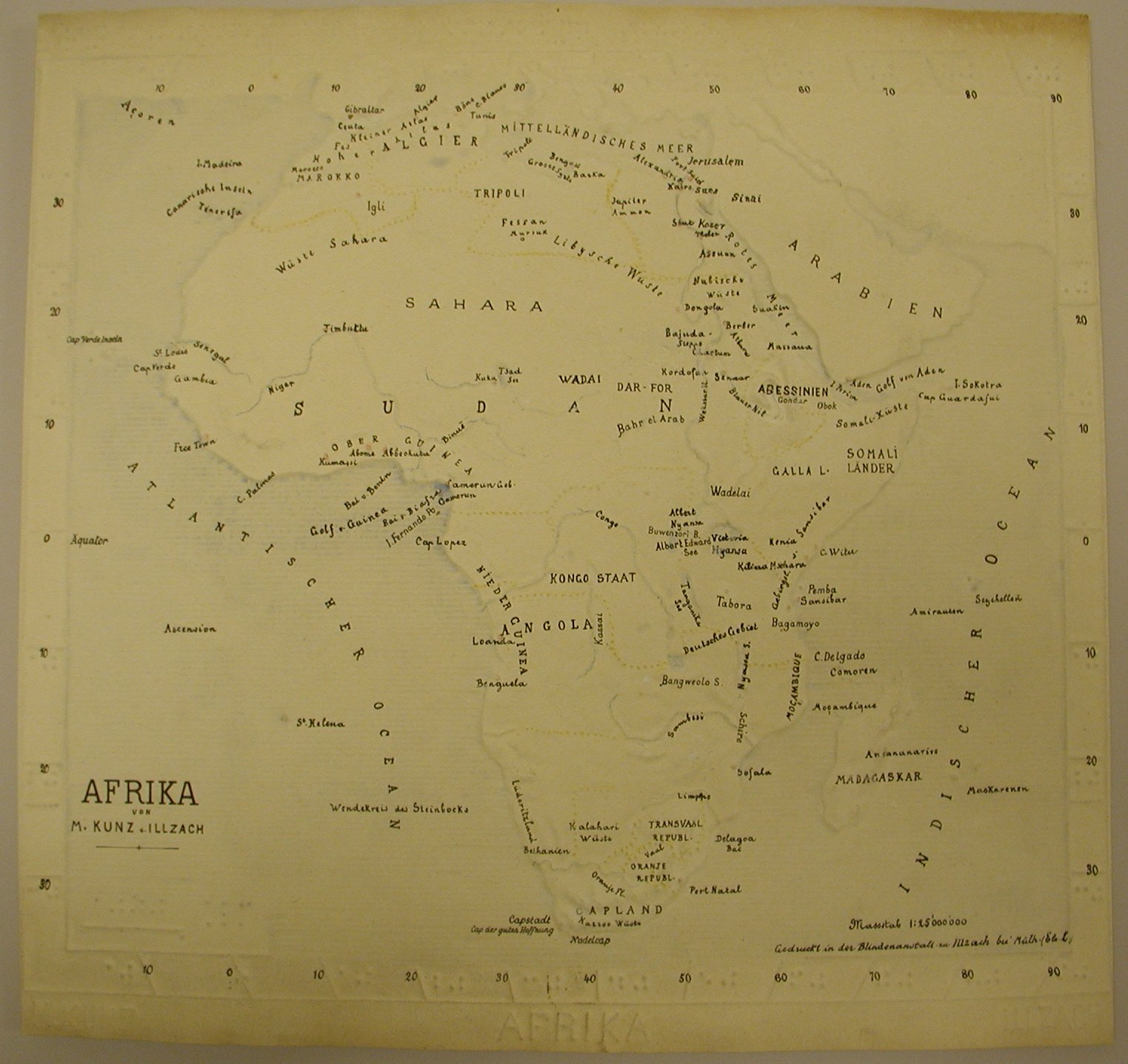
- Scope & Content:
- Relief map of Africa; title, creator, and creator's location identified in raised letters, at bottom; German braille, at top, provides name of publisher (Verein zur Forderung der Blindenbildung, Steglitz, Berlin), and date; "Afrika von M. Kunz, Illzach" in print, lower left corner; mapped area has hand-inked print labeling; large bodies of water have slightly raised horizontal lines and are gently highlighted in blue; landmass is slightly higher and mountainous areas are raised; borders are represented by dotted lines, colored yellow; major cities are indicated by raised red dots; rivers are indicated by raised blue lines; latitude and longitude are represented by short raised lines with braille and print numbers around perimeter of mapped area. Coloring may have been done by hand with colored pencil and/or watercolors. Martin Kunz was the director of the Blind Institute at Illzach, Germany and the leading producer of maps in Europe during the 1890s.
- Creator:
- Kunz, Martin.
- Interview Date:
- / /
- Collection:
- APH Collection
- Credit Line:
- APH Collection, 1998.80
- Publisher:
- Steglitz/Berlin, Germany
- Publisher Place:
- Steglitz/Berlin, Germany
- Publish Date:
- 1888
- Subjects:
- Africa Geography Maps for the blind and visually impaired