- Accession Number:
- 2001.173.4
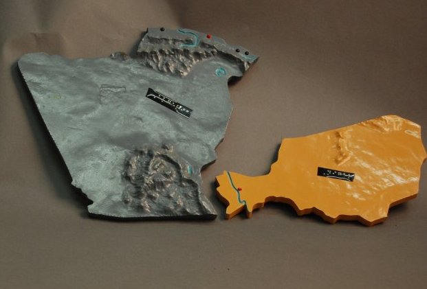
- Description:
- Easel-type dissected relief map of Africa; pieces formed from two layers, a molded epoxy relief layer adhered to a foundation layer of epoxy board, cut to shape after gluing as revealed by the band saw lines on the sides; dissected countries lift out of a recessed outline frame with black trim; main bodies of water are depressed from landmasses and are enameled blue; mountains are raised; countries are enameled in green, gold, pink, gray, and sand; national and regional capital cities are indicated by pointed red tack heads; other cities are rounded tack heads; braille Dymo tape labeling; all pieces stamped on reverse, "#1".
- Height:
- 47
- Width:
- 38
- Depth:
- 4
- Date Made:
- ca. 1960
- Place of Origin:
- Louisville, KY
- Collection:
- KSB Collection
- History/Provenance:
- KSB Collection
- Subjects:
- Africa. Geography. Instructional aids, tools, and supplies. Maps for the blind and visually impaired Tactile graphics.
- Made:
- American Printing House for the Blind
- Material:
- Plastic
- Updated:
- 02/15/2021